Improved Situational Awareness in Fisheries (ISAIF)
Using satellites to improve fisheries management and tackle illegal fishing in the Philippines

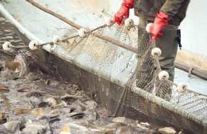
Man fishing with net
Project lead
Janus TCD
Target Country
The Philippines
Project consortium
Nick Lambert Associates Ltd (NLA Ltd), Earth Observation, OceanMind, Poseidon Aquatic Resource Management Ltd
International partners
The National Coast Watch Centre, Philippines: co-ordinates activity between and assets belonging to:
- The Philippine Coast Guard
- Bureau of Fisheries and Aquatic Resources
- The Philippine Navy
- The Philippine National Police-Maritime Group
Project Summary
The Bureau of Fisheries and Aquatic Resources (BFAR) in the Philippines has identified several core problems of the fisheries sector, notably loss of marine biodiversity, declining fish stocks, and loss of revenues from fisheries and coastal resources. These problems have been attributed to illegal, unreported and unregulated fishing (IUU) including destructive fishing, overfishing, coastal and habitat degradation, siltation, pollution, postharvest losses and inefficient marketing.
The premise of ISAIF is to establish a system that supports improved situational awareness within fisheries management systems in the Philippines. The ISAIF system will enable the Philippine Government to reduce the impact of Illegal, unreported and unregulated fishing (IUU).
The project will help the Philippine government to better understand, benchmark, monitor and support the activity of 4 million largely unmonitored artisanal fishers. Further steps need to be taken to authenticate the fishing catch by this sector to support legal, sustainable fishing.
Because so few of the fishing vessels have tracking units that could enable effective monitoring, there is a critical need to evaluate different technologies as well as for analytical support and capacity building to relevant agencies to promote the monitoring and control required for sustainable fisheries.
There is also a tremendous need for the application of technologies and techniques that can help identify ‘dark vessels’ that do not transmit an identifier that would enable oversight of their activities. These may be Philippine flagged vessels engaged in IUU fishing in closed areas such as the nearshore exclusion zone for artisanal vessels or could be foreign flagged vessels illegally encroaching on the waters of the Philippines Exclusive Economic Zone.
Several remote sensing technologies could be used to detect these dark vessels, ideally in parallel with a fisheries analytic capability to cross-reference a database of threat profiles and other tracking systems to quickly and clearly provide threat assessments to efficiently deploy an enforcement response. Unlike traditional solutions, this project will demonstrate both conventional satellite-based IUU fishing techniques combined with innovative and potentially disruptive low-cost satellite navigation-based technology. This will allow – for the first time – not only coverage of commercial fishing activity, but coverage of subsistence artisanal fishing, which up until now has been excluded from conventional fishing monitoring technology due to the (relatively) high cost.
This will help to protect and grow a fisheries sector that contributes approximately $1.2bn to the country’s GDP, supplies over 50% of animal protein consumed by the population and employs more than 4 million people.
Objectives
- Gain greater understanding of the size and nature of the IUU fishing issues in Philippine fisheries by conducting a regulatory review and detailed problem assessment.
- Bring new, cutting edge data analysis tools to bear to allow for more effective surveillance & monitoring, effective enforcement, deterrence and compliance.
- Improve maritime safety in the Filipino commercial and artisanal fishing fleet.
- Improve the Philippine government’s ability to track its fleet by installing up to 200 new VMS units on fishing boats and then collecting an evidence-based trials data set used to inform Filipino policy on a national roll out of such a system.
- Provide the artisanal fishing fleet with a new, low-cost, scaleable digital method of authenticating their catch. Demonstrate the effectiveness of this system.
- To initiate a system that will in time provide volume, location and species data on catch to ensure scientists have the best database from which to improve productivity / aid sustainability.