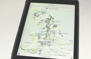
A mine of information on your mobile
The Coal Authority has made its Interactive Map Viewer available for mobile devices.

The Authority's updated Interactive Map Viewer
The Coal Authority has launched a mobile friendly version of its popular Interactive Map Viewer, which allows anyone to view selected coal mining information on a smart phone or tablet. The new version is now available on gov.uk/coalauthority and helps people to find out if a property is near coal mining features. The viewer doesn’t replace the need for a detailed coal mining report. People should still check if a coal mining report is needed by visiting the Coal Authority Online Services - www.groundstability.com.
The Interactive Map Viewer allows people to check for coal mine entries at or near the surface. It also allows planners and developers to check if a site is in a development high risk area. Low and high risk development areas have been defined by the Coal Authority using their extensive mining records.
Data on the Coal Authority’s Interactive Map Viewer represents a snap shot in time from the national coal mining database, which is regularly updated with new information on past and present coal mining.
Louise Tipper, Information Manager, Coal Authority said:
Our updated Interactive Map Viewer uses a responsive design so it’s much easier to use on mobile devices. The new version also allows people to view the data on a full screen on their laptop or PC. Users can turn on selected data layers to allow them to see various coal mining data on top of the map. Clicking on any data points or areas will provide further detailed information. Users can easily check a particular location by either entering a postcode or zooming into the area they’d like to view.
The Interactive Map Viewer also includes INSPIRE compliant data for professional GIS users, enabling them to stream data directly to their own GIS.