British-built satellites will help fight climate change and save wildlife
Three UK-built satellites are set to launch on a SpaceX rocket on Friday, showcasing the UK's strengths in new technology

Update, 24 June: Launch has been postponed – further updates to follow.
Monitoring and tackling climate change and tracking endangered wildlife are among the exciting features of three UK-built satellites set to launch on a SpaceX rocket on Friday 25 June.
UK companies have received nearly £15 million from the UK Space Agency, through the European Space Agency’s Pioneer Partnership Programme, to develop the trio of satellites due to lift off from NASA’s Kennedy Space Center in Florida.
Lacuna Space, based at the Harwell Space Cluster in Oxfordshire, is revolutionising the cost and simplicity of connecting sensors to the internet, reaching every corner on Earth using small satellites to support the Internet of Things.
Lacuna sensors, which fit in the palm of your hand and run for years off a single battery charge, can be used to monitor the environment, track wildlife and help farmers by providing data on the health of cattle and crops and for water and soil management.

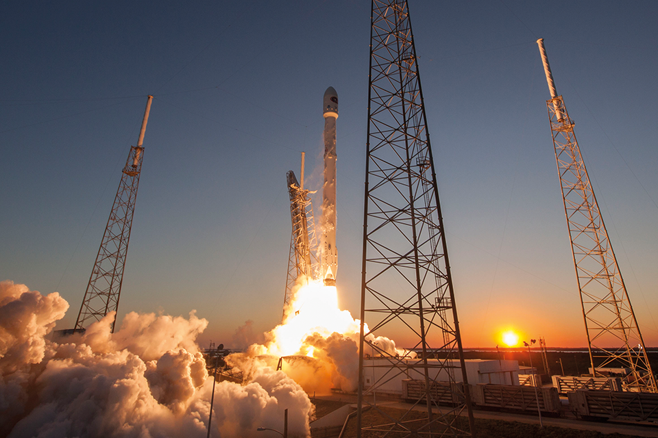
The satellites will launch aboard a SpaceX Falcon 9 rocket. Credit: SpaceX
Science Minister Amanda Solloway said:
As we get ready to host the UN Climate Change Conference, COP26, in Glasgow later this year, the UK is leading the way in exploiting space to tackle climate change, developing satellites that enable our world class scientists to monitor the environment in remarkable detail.
As well as supporting out climate ambitions, these British-built satellites will provide exciting innovation in remote sensing and tracking, kickstarting industry to offer new services that will help to improve all our lives.
Two of the satellites, built by Spire, in Glasgow, will develop optical intersatellite links (ISL) which will provide a step change in how we get large amounts of data from space down to Earth. This will enable constellations of satellites to become integrated networks in space, capable of delivering very high volumes of data at speed to anywhere in the world, including remote and rural areas, disaster areas and at sea.
This enhanced data and better predictive analytics will improve our understanding of the environment and the impact we have on it.
Spire has been supported by the UK Space Agency, through the European Space Agency’s Pioneer Partnership Programme with nearly £9 million of total funding, to develop a range of innovative technologies and data platforms including the pair of satellites planned for tomorrow’s launch.
Elodie Viau, Director of Telecommunications and Integrated Applications at ESA, said:
ESA is proud to enable small and medium-sized enterprises in Europe to become space mission providers and enter the space industry through programmes such as Pioneer. It provides innovators and entrepreneurs with the means to access space through cost-effective processes, creating jobs and boosting prosperity, and supporting the success of the European and Canadian space industry in the highly competitive global telecommunications market.
Theresa Condor, Executive Vice President and General Manager of Spire Space Services, said:
At a critical time for our planet, and with COP26 taking place later this year, we need to be able to map out and report on rapidly changing phenomena on Earth. That is the core purpose of Spire’s constellation. Enhanced data and better predictive analytics help us to further understand our environment and the impact we have on it.
Optical ISL allows us to deliver the most time sensitive data faster and at higher volumes for critical applications such as weather monitoring and forecasting.
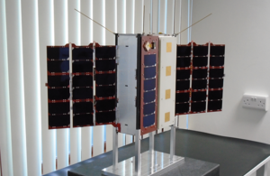
The third satellite is built by In-Space Missions, based in Hampshire, supported by £4.9 million of funding for this and future validation missions expected to launch in 2022/2023. The Faraday Phoenix satellite incorporates payloads for six customers including Airbus, Lacuna, SatixFy and Aeternum.

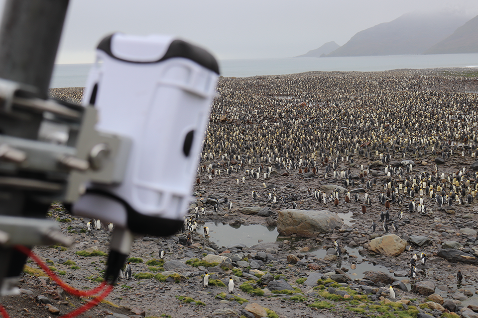
Lacuna sensors have been used to monitor king penguins. Credit: Lacuna Space
Doug Liddle, CEO at In-Space Missions, said:
The team here at In-Space is incredibly proud to be launching our highly capable and innovative satellite which has come together in less than a year. We’re particularly excited to be flying on a Falcon 9 from Cape Canaveral - a location with such an amazing history.
The In-Space satellite includes the demonstration payload for Lacuna Space, which is developing a ground-breaking satellite IoT service, thanks to £800,000 in funding. This is the next step in Lacuna’s space network, further improving the company’s capability to service massive deployments for the IoT.
Rob Spurrett, Lacuna’s CEO, said:
Much like the early days of the internet, when it was hard to imagine the impact of having everybody connected, it seems there is an endless world of possibilities from now connecting physical objects or “things”. In cities there are many possible ways to do that, but our service ensures that rural parts of the UK and even the most remote locations in the world are part of this data revolution.
The SpaceX Falcon 9 rocket is due to launch from NASA’s Kennedy Space Center in Florida. The four-hour launch window opens at 8pm BST on Friday 25 June.
Taxi ride to space - other payloads on the Faraday Phoenix mission:
The mission will fly In-Space’s own Babel payload as the first incarnation of a future digital, uploadable payload offering within the Faraday service. This first version is a high gain, wideband software defined radio with enabling a number of different applications to be uploaded and exercised – from tracking ship radars to creating heat maps of 4G mobile usage.
SatixFy Space Systems, based in Manchester, is using the mission to demonstrate their satcom technology in space for the first time. SatixFy’s cubesat computer will be the most capable product of its type on the market, supporting up to 4Gbps of data transmission, and allowing companies to process large amounts of data in orbit. The Airbus Prometheus 1 payload, built in Portsmouth, with a Software Defined Radio will be able to survey radio spectrum usage across the world from orbit, detect radar tracking of the Faraday Phoenix satellite, and potentially identify and locate search and rescue beacons.