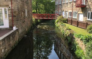
Improved flood warning service now covers more properties
Four new communities near Meanwood Beck, Leeds, are now included

Meanwood Beck
The Environment Agency has improved its flood warning systems across West Yorkshire.
The updated service uses new modelling data, which gives more accurate alerts, helping communities to be better prepared for flooding.
As part of this latest update, four new communities near Meanwood Beck, Leeds, covering more than 3,000 properties are now included in the flood warning service. They are:
- Meanwood Beck at Headingley and Weetwood, including properties on and close to Weetwood Mill Lane, Stone Mill Way, Mill Pond Lane, Boothroyd Drive and Sugar Well Road.
- Meanwood Beck at Busingthorpe and Sheepscar, including properties on and close to Meanwood Road, Buslingthorpe Lane, Buslingthorpe Mills, Sackville Street and Barrack Street.
- Meanwood Beck at Sheepscar, Mabgate and Quarry Hill, including properties on and close to Sheepscar Street, Regent Street and Saint Peter’s Street.
- Gipton Beck and Gledhow Beck, including properties on and close to Roundhay Road, Markham Avenue and Gledhow Valley Road
Due to these changes, the Environment Agency is encouraging Leeds residents and local businesses to check if they are at risk of flooding and to sign up to receive the flood warning service so they can be aware of when flooding is possible.
Residents can find out if they are eligible to receive flood warnings, and then registering, by calling Floodline on 0345 988 1188, or by visiting www.gov.uk/check-flood-risk.
This website also includes information about how to be better prepared for flooding.
Dr Jenny Armstrong, Environment Agency flood resilience officer, said:
The becks in these communities can rise very quickly after heavy rain, so providing warnings can be difficult, but our new and improve warnings aim to alert the community in a timely manner, giving people more time to prepare, and to be aware of possible flooding so that they do not put themselves at danger.