New sections of England Coast Path to open in the North West
33.3 miles (53.3km) of new King Charles III England Coast Path from Gretna to Allonby have opened.

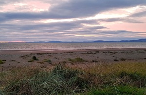
Allonby Bay
Today, (23 November), two new sections of the King Charles III England Coast Path from Gretna to Allonby have opened in Cumbria.
The new sections, from Gretna to Kirkandrews-on-Eden and between Rumbling Bridge and Allonby total 33.3 miles (53.3km), of which 9.9 miles (15.9km) provides entirely new or significantly improved access to a wide range of coastal terrain and historical sites.
Starting at Sark Bridge, at the border with Scotland, the path parallels the M6 Motorway and the West Coast Mainline railway initially. Walkers then cross the River Esk on Metal Bridge, then round Rockcliffe Marsh to trace the River Eden upstream before crossing at Stainton to head back downstream on the opposite bank, to Kirkandrews-on-Eden.
A second section of the path begins just north of Abbeytown, before running across Calvo & Skinburness Marsh, round Grune Point and heading south through Skinburness, Silloth, Beckfoot and Mawbray to Allonby.
Natural England is working to open the remaining central part of the stretch to walkers in the near future and, when completed, the new path will provide a continuous walkable stretch 65.79 miles (106km) along the Cumbrian coast linking with the 80.4 miles (129.44km) that are already open in the region.
Path highlights
Highlights of the path include:
- Solway Firth National Landscape
- Rockcliffe Salt Marsh Site of Specific Scientific interest; one of Britain’s largest saltmarshes home to wildlife such as oyster catchers and pink-footed geese.
- RSPB Campfield Marsh reserve covering 65 hectares of raised peatbog north west of Bowness-on-Solway.
- Hadrian’s Wall including archaeological sites such as The Vallum earthwork and Skinburness Milefortlet 9.
Gerry Rusbridge Natural England Senior Advisor for Cumbria said:
The new path opens up beautiful new countryside to the public, aiming to make it easier for as many people as possible to experience this remote and often wild part of the North West coastline.
Working closely with the access authority – Cumberland Council – we are ensuring that large parts of the newly opened path are as accessible as possible, including the parts of the route that follow existing public rights of way, where we’re removing barriers such as stiles, and making other accessibility improvements.
Councillor Denise Rollo, Cumberland Council’s Executive Member for Sustainable, Resilient and Connected Places, said:
We are delighted to see the opening of these latest stretches of the King Charles III England Coast Path in Cumberland which will attract more visitors to our wonderful coast and help boost our local tourism economy.
These new accessible routes will make it easier for local communities and visitors to explore the rich natural and cultural heritage on our coast whilst enjoying all of the health benefits which being outdoors and connecting with nature gives us.
Once completed, the King Charles III England Coast Path will be the longest managed coastal walking route in the world. Walkers and people who enjoy exploring the coast use the National Trails website to plan their visits. See www.nationaltrail.co.uk.