Royal Navy finds uncharted Red Sea mount
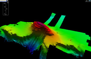
Royal Navy survey ship HMS Echo has discovered a previously uncharted underwater 'mountain' on the bed of the Red Sea the size of the rock of Gibraltar.

Multibeam echo sounder imagery of the uncharted sea mount discovered by HMS Echo in the Red Sea [Picture: Crown Copyright/MOD 2012]
The hi-tech sonar suites of the Devonport-based survey ship mapped the huge feature for the first time, and it will now be marked on charts to prevent other seafarers running into it.
Echo was sent east of Suez at the beginning of last year to help improve charts of the region’s waters and gather key hydrographic data.
The enormous mound - the correct term is ‘sea mount’ is quite literally the biggest success of Echo’s deployment.
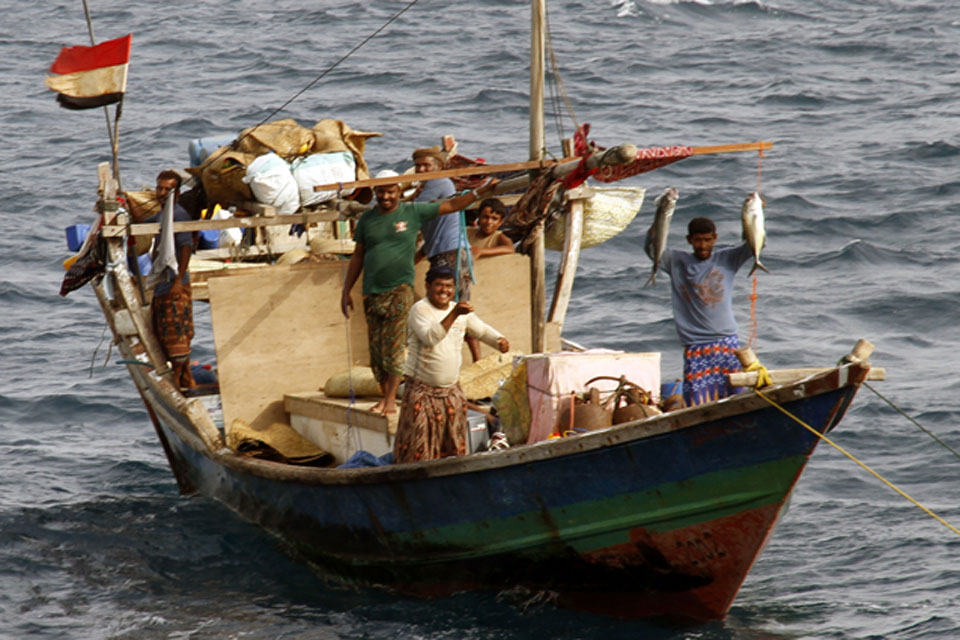
Yemeni fishermen evidently knew the mount existed - Echo found a dhow anchored on its summit as she carried out her survey of the area.
Existing charts of the area suggested the sea was 385m (1,263 feet) deep, but over an eight-hour period Echo collected reams of information with her sounders to prove otherwise.
24 hours later, after processing all that information, the survey ship’s powerful computers produced stunning 3D imagery which revealed the true extent of the mount.

Yemeni fishermen at anchor on the sea mount [Picture: Crown Copyright/MOD 2012]
It rises to just 40m (131ft) below the surface of the Red Sea - deeper than the deepest draught of any civilian or military surface ship, but a definite danger to submarines passing between the Mediterranean and the Middle East:
We were actually looking for volcanoes - the southern Red Sea region has seen a significant amount of recent tectonic and volcanic activity with several volcanoes emerging from the sea close to the Yemeni coast line,” said Commander Matt Syrett, Echo’s Commanding Officer.
We didn’t find any. But we did find this. It is absolutely massive, and finding it is something which really makes everybody on board feel good.
So often it’s difficult to show that what the Navy does has a tangible effect. This is visible proof. We found it and, as it’s a danger to other seafarers, it’s been reported to the United Kingdom Hydrographic Office and is expected to appear on new charts of the region in the near future.
Now in the Mediterranean, Echo’s finds have continued with the possible wreck of a Second World War ‘Liberty Ship’ a dozen or so miles off Tripoli. Standing 22m (72ft) proud of the seafloor, 105m (344ft) long and 22m wide; the object is the length of 11 double decker buses parked in nine rows and stacked five deep.
Once again the UK Hydrographic Office, which provides charts for the Royal Navy and many of the world’s merchant mariners, has been informed so other sea users can be warned of Echo’s discovery:
From the shape of the hull and location of the superstructure it is likely to be an old Liberty Ship, and was most likely another casualty of World War 2,” said Cdr Syrett.
In the 18 months since Echo left UK waters, she has carried out a wide range of essential survey tasking, from supporting assault ship HMS Albion during amphibious exercises in the Gulf last summer, to improving navigational safety for merchant shipping in the Gulf and Red Sea and carrying out oceanographic research off the Horn of Africa.
Please tell us what you think about government news on the web by filling in the short survey at Related Links.