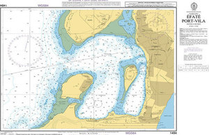
UKHO releases two Special Purpose Charts to support Vanuatu relief effort
UKHO releases two Special Purpose Charts to support Vanuatu relief effort.

The South Pacific island chain of Vanuatu was devastated on March 13th by Cyclone Pam. This event is now regarded as one of the most severe tropical cyclone disasters in the history of Vanuatu, and has resulted in the tragic loss of 16 lives. The majority of the damage is at the capital of Port Vila, although other parts of the 65 inhabited islands have also been affected by the natural disaster. The United Nations have confirmed that humanitarian aid has been delivered to all of the affected islands of the country, providing food packages and water for more than 166,000 people, however, this important work will continue for as long as necessary in support of the affected communities.
As the producers of Official Navigational products for Vanuatu, the UKHO has released two Special Purpose Charts that will be made available in digital format, free of charge for use by all interested parties and to assist with the humanitarian relief effort. The charts are; 1638S, Luganville at a chart scale of 1:20 000 and 1494S, Efate, Port Vila at a chart scale of 1:10 000. It should be noted that these products have been produced rapidly in response to the disaster and therefore have not undergone the full validation process that our standard paper products would normally receive; users of these charts should therefore exercise due caution when using them for navigation. The standard paper products for this region will be updated in due course.
In addition to these Special Purpose Charts, new editions of two Vanuatu ENC cells, GB501638 Northern Vanuatu - Espiritu Santo - Luganville and GB501494 Port Vila, originally scheduled for publication in June and July, have been bought forward and are available as of today. These products will be distributed through IC-ENC on a free of charge basis for use by all interested parties and to assist with the humanitarian relief effort.