Licence areas data set: User guide
Updated 16 August 2024

© Crown copyright 2024
This publication is licensed under the terms of the Open Government Licence v3.0 except where otherwise stated. To view this licence, visit nationalarchives.gov.uk/doc/open-government-licence/version/3 or write to the Information Policy Team, The National Archives, Kew, London TW9 4DU, or email: psi@nationalarchives.gov.uk.
Where we have identified any third party copyright information you will need to obtain permission from the copyright holders concerned.
This publication is available at https://www.gov.uk/government/publications/coal-mining-data-licence-areas/licence-areas-data-set-user-guide
1. Introduction
The Coal Authority manages the effects of past coal mining, including subsidence damage claims which are not the responsibility of licensed coal mine operators. It deals with mine water pollution and other mining legacy issues. It also owns, on behalf of the country, the majority of the coal in Britain, and licenses coal mining.
We use our skills to provide services to other government departments and agencies, local governments and commercial partners. We contribute to the delivery of the UK Government’s Industrial Strategy and the environmental, social and economic priorities of the UK, Scottish and Welsh Governments.
By sharing our knowledge and expertise we support them, and our partners, to create cleaner, greener nations for us all.
Our purpose is to:
- keep people safe and provide peace of mind
- protect and enhance the environment
- use our information and expertise to help people make informed decisions
- create value and minimise cost to the taxpayer
The Coal Authority is an executive non-departmental public body, sponsored by the Department for Energy Security and Net Zero.
Further information on all the digital data available from the Coal Authority
2. Information about the licence areas data set
2.1 Background
Upon privatisation of the coal industry in October 1994 and the demise of British Coal, the Coal Authority was set up to take over a number of British Coal’s responsibilities, however these did not include the physical extraction of coal.
It is the responsibility of the Coal Authority to license and monitor the extraction of coal by private operators.
A licence is required for:
- the mining of coal
- the exploration for coal
- the exploitation of coal methane
- underground coal gasification
- mine water heat recovery
- deep energy boreholes
- digging and carrying away coal during a non-coal related development
It’s an offence to carry out coal mining operations without a licence.
The details of the licences created since October 1994 have been captured in the Coal Authority’s National Coal Mining Database.
2.2 Data set history
The licence areas spatial data set created during the early 1980s in readiness for the automated provision of coal mining reports that was introduced locally in 1985 and established nationally in 1989.
A team of qualified National Coal Board or British Coal Corporation mining surveyors were engaged to rationalise the mining and other source plans, reference them to Ordnance Survey National Grid or County Series and capture the data into the first computerised mining report system.
The spatial data sets were subsequently migrated into the Coal Authority’s current ESRI based geographic information system (GIS) in 2011.
2.3 Who might require this data set?
This data set is currently used by the Coal Authority in the production of CON29M mining search reports. These provide property specific searches with regard to potential mining hazards in support of the conveyancing market.
This data set is suitable for use by organisations wishing to identify possible ground instability and potential mining hazards. Users may include but are not limited to local authorities, infrastructure operators, land developers, home-owners, solicitors, loss adjusters, the insurance industry, architects and surveyors.
2.4 What the data set shows
The layer shows the position for each licence area relating to both underground, opencast and underground coal gasification as taken from the information held by the Coal Authority, and includes a number of attributes relating to that feature.
This data set should be looked at in conjunction with the unlicensed opencast dataset in regard to opencast operations before 1994.
This data set should be used in conjunction with the licence table data set to ensure that licence areas are reported fully. This is a specific requirement of the CON29M report.
2.5 Coverage
The coverage of the licence areas data set is the known extent of coal mining activity in Great Britain. This area does not represent the full extent of geological coal reserves and resources.
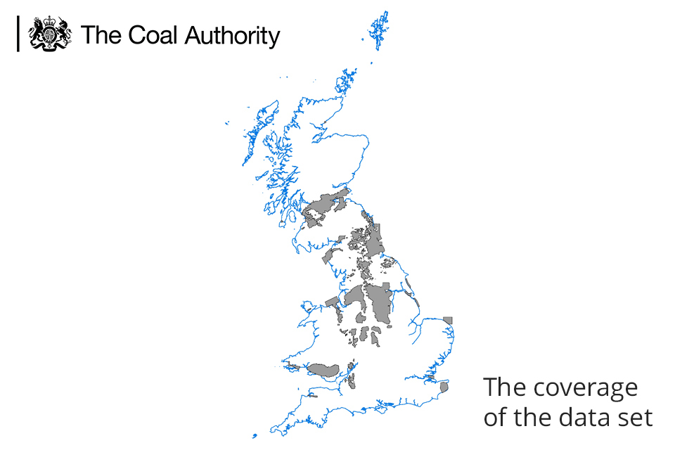
A map showing Great Britain and the coverage of the data set.
3. Technical information
3.1 Definitions – licence and conditional licence
A licence is granted by the Coal Authority to a licensee to extract or otherwise work coal.
A conditional licence does not immediately give the licensee the power to mine coal and is conditional on other rights and permissions being obtained, most notably planning permission and surface access rights for the mine site.
3.2 Source accuracy limitations
All plans are representations and may contain inherent simplifications due to generalisation. When features are represented on plans, their scale often determines the level of detail shown. In addition to these simplifications, limitations may also be introduced through the drawing process.
3.3 Digitisation process accuracy limitations
Licence areas are faithful representations of their source licence plans but are subject to the inherent, albeit minor, inaccuracies resulting from the georeferencing and the digitisation process.
3.4 Scale
The original plans were produced at varying scales, but were in general digitised to a scale of 1:2,500.
3.5 Data format
The licence areas data set has been created as vector polygon data and is available is supplied in ESRI File Geodatabase (.gdb) format. Other geospatial formats, including geopackages and computer-aided design, can be supplied on request but may incur additional processing costs.
The layer file provided will describe the symbology used by the Coal Authority and has been created using ESRI ArcGIS V10.7.1
Use of any other symbology is not advised for this data set as the symbology used by the Coal Authority is an industry standard and any change of this could significantly affect the perceived understanding.
In order to view the correct symbology the layer file should be loaded in your GIS system.
3.6 Field descriptions
| Data field | Explanation of data field |
|---|---|
| OBJECTID | OBJECTID File GeoDB ID number |
| S_OBJECTID | Source ObjectID Unique Coal Authority ID number |
| GLOBALID | GLOBALID Globally Unique Identifier |
| L_RFRNC | Licence Reference Unique Coal Authority licence reference. Primary Key The primary key should be used to relate this data set to information held in the licence table data set to ensure CON29M questions are answered fully. |
| SITENAME | Site Name Name of site. |
| L_TYPE | Licence Type Underground, opencast or underground coal gasification. |
| STATUS | Status Current status of the licence - past, current or future. Note: a single licence can be related to licence areas of all status. |
| CNDTNS | Conditions Was the grant of the licence conditional? True or False. |
3.7 Coal Authority rules set for meeting the requirements of the Law Society’s CON29M questions
Underground
Future licence - awaiting determination:
- licence area type is underground
- licence area status is future
- related licence, L_TYPE equals underground or underground coal gasification
- related licence, L_STATUS equals application
Future licence – granted - conditional:
- licence area type is underground
- licence area CONDITIONS equals true
- licence area STATUS equals future
- related licence, L_TYPE equals underground or underground coal gasification
- related licence, L_STATUS equals granted
Future licence – granted – unconditional:
- licence area type is underground
- licence area CONDITIONS equals false
- licence area STATUS equals future
- related licence, L_TYPE equals underground or underground coal gasification
- related licence, L_STATUS equals granted
If the related licence, L_STATUS equals revoked, withdrawn or cancelled the licence is not reportable within CON29M.
Opencast
Past opencast
Determine if any LICENCE AREA intersect report boundary where:
- licence area – TYPE equals opencast
- licence area – STATUS equals past
Present opencast
Determine if any LICENCE AREA intersect or are within 200m of the report boundary:
- licence area – TYPE equals opencast
- licence area – STATUS equals current
- related licence - L_STATUS equals granted
Future opencast – awaiting determination:
Determine if any LICENCE AREA intersect or are within 800m of the report boundary:
- licence area – TYPE equals opencast
- licence area – STATUS equals future
- related licence – L_STATUS equals application
Future opencast:
Determine if any LICENCE AREA intersect or are within 800m of the report boundary:
- licence area – TYPE equals opencast
- licence area – STATUS equals future
- related licence – L_STATUS equals granted
If the related licence, L_STATUS equals revoked, withdrawn or cancelled the licence is not reportable within CON29M.
4. Data update frequency
The Coal Authority is constantly reviewing and updating its data. We therefore make no representation that the licence areas data set remains complete, accurate, up-to-date, reliable or exhaustive. Weekly, annual or one-off updates will be provided as per the licence arrangement.
5. Licensing information
The Coal Authority does not sell its digital spatial data to external parties. Instead, it grants external parties a licence to use the data, subject to terms and conditions. In general, a licence fee will be payable based on the type of data, geographic area required, the number of simultaneous users, and the duration (years) of a licence.
All recipients of a licence are required to return a signed licence document to us before authorisation for release of digital data is given.
These are general comments for guidance only. Full details of the terms and conditions of supply are included within licences.
The Coal Authority’s data team will be happy to discuss your proposed use of data and can be contacted at datasolutions@coal.gov.uk .
The data team will usually be able to provide reassurance that the licence will cover individual user requirements or include additional ‘special conditions’ in the licence documentation, addressing specific requirements within the Coal Authority’s permitted usage.
6. Limitations and exclusion of liability
The Coal Authority is committed to ensuring that the digital data it holds and releases to external parties under licence has been through a robust internal approval process to ensure that corporate quality assurance standards are maintained.
This approval process is intended to ensure that all data released:
- is quality assured
- meets agreed data management standards
- is not in breach of any third party intellectual property rights or other contractual issues - such as confidentiality issues
6.1 Limitations
This data set is based on, and limited to, an interpretation of the records in the possession of the Coal Authority at the time the data set was created.
The data set does not categorise the risk of surface collapse and no account is taken of any past remediation that may have been undertaken.
An indication of the presence of a coal mining related feature, such as a mine entry, does not necessarily mean that a location will be affected by ground movement or subsidence. Such an assessment can only be made by inspection of the area by a qualified professional.
If customers are uncertain about the use of particular data they should seek professional advice. However, they may consult the Coal Authority’s data team on technical matters, licensing arrangements, or general aspects including the appropriateness and limitations of the data.
6.2 Exclusions
The databases comprising the subject matter of this report are made up of information supplied to the Coal Authority by third parties under statutory obligation and of which the Coal Authority has no direct knowledge and has not necessarily had the opportunity to verify. Accordingly, it can have no liability for the accuracy of the information comprising the databases or for any loss of whatever nature directly or indirectly caused which may result from any reliance placed upon it.
The licensee takes the information as provided without any such express or implied warranty and must rely upon its own enquiries and where necessary obtain appropriate insurance against any loss arising.