Coastal and estuary management
Published 12 February 2025
Applies to England and Wales

© Crown copyright 2025
This publication is licensed under the terms of the Open Government Licence v3.0 except where otherwise stated. To view this licence, visit nationalarchives.gov.uk/doc/open-government-licence/version/3 or write to the Information Policy Team, The National Archives, Kew, London TW9 4DU, or email: psi@nationalarchives.gov.uk.
Where we have identified any third party copyright information you will need to obtain permission from the copyright holders concerned.
This publication is available at https://www.gov.uk/government/publications/natural-flood-management-evidence/coastal-and-estuary-management
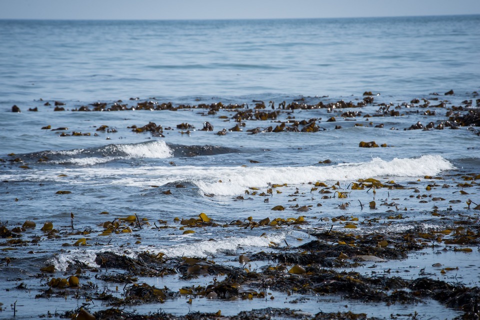
1. Saltmarsh and mudflat management/restoration
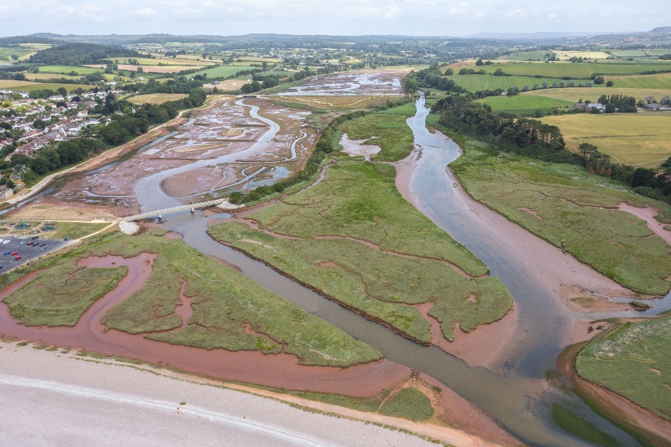
Saltmarsh restoration, Lower Otter restoration project. Image credit: Clinton Devon Estates
Saltmarsh and mudflats reduce and dampen wave and tidal energy in front of flood defences.
They can reduce the forces affecting flood defences and reduce tidal surges, leading to slightly lower water levels at defence structures. This means that they can extend the design life of a flood defence.
1.1 What we know
We have high confidence in the effect that saltmarsh and mudflat management have on flood and coastal erosion risk.
We know that:
- saltmarshes reduce wave energy, with vegetation increasing the level of attenuation
- saltmarshes can be further protected by restoring other habitats seaward that attenuate forces and reduce erosion of the saltmarsh edge, while also creating living shorelines and habitat mosaics that benefit connectivity
- flexible marsh species attenuate less wave energy, however, they are more likely to survive under storm conditions
- variations in mean wave energy, which may occur during storm events, may cause erosion to saltmarshes, but can also provide sediment
- further examples now exist that help improve understanding of how long managed realignment schemes and linked saltmarsh and mudflat habitats take to establish
- numerical models have been developed to account for drag forces from saltmarsh vegetation
- beneficial use of dredged sediment (BUDS) is a tool that can support a wide variety of habitats, but application depends on the sediments being dredged; the potential impacts of dredging mean BUDS should only be used where excess sediment is available from management for other primary aims (for example, navigation)
1.2 Examples
At the Hesketh Out Marsh managed realignment site, 322 ha of priority saltmarsh habitat will help to provide a more robust flood defence system, providing a 1 in 200-year standard of flood protection to 143 residential properties, 3 commercial buildings and 300 ha of farm land.
Field measurements on the Scheldt Estuary, Groot Buienschoor (Belgium) and the Schor van Rilland (Netherlands) identified that wave attenuation rates ranged from a 20 to 40% reduction in wave height over the first 12 m of the marsh (Silinksi and others, 2018).
Modelling showed a 75% reduction in wave height for a 10-year return period when encountering marsh vegetation. This effect decreased with increasing return period (Godfroy and others, 2017).
UK projects include the Lower Otter Restoration Project, and Greatham South.
1.3 Multiple benefits
Saltmarshes and mudflats provide a wide range of benefits across most of the ecosystem services. The greatest ecosystem service benefits associated with this measure are biodiversity, climate regulations and flood and coastal risk management.
New literature suggests that saltmarshes and mudflats are able to regulate climate by storing large quantities of carbon and are widely recognised as being able to filter sediments and nutrients, therefore, improving water quality. They also provide potential amenity benefit. Water resource benefits are not relevant due to salinity.

1.4 What we need to learn more about
We need to better understand:
- long-term flood risk benefits of managed realignment schemes through monitoring
- benefits of smaller scale living shorelines
- UK-based examples on the influence of species type
- different types of vegetated marshes
- estuarine and coastal sediment loads and processes, and the relationship between sediment change and vegetated marshes
- optimal approaches for supplying sediment to marshes through the beneficial use of dredged sediments, including volumes and methods (for example, thin-layer disposal)
- cumulative impacts of winter storms on saltmarshes and tidal flats
- the pressures resulting in the erosion of existing saltmarshes and tidal flats
- methods to protect saltmarsh edges, including features such as oyster-based substrates and any associated risks
- models to evaluate economic and environmental costs and benefits of saltmarsh and mudflat management
- the influence of tidal flats on flood risk and best management practices
1.5 References
GODFROY, VUIK, VAN BERCHUM, & JONKMAN, 2017. Quantifying Wave Attenuation by Nature-based Solutions in the Galveston Bay. TU Delft
SILINSKI, SCHOUTENS, PUIJALON, SCHOELYNCK, LUYCKX, TROCH, MEIRE, & TEMMERMAN, 2018. Coping with waves: Plasticity in tidal marsh plants as self-adapting coastal ecosystem engineers: Marsh plants as self-adapting ecosystem engineers. 63 (2). Limnol. Oceanogr. 799–815
2. Beach nourishment
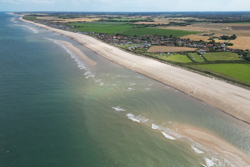
Beach nourishment, Bacton Sandscaping. Image credit: Coastal Partnership East (CPE)
Beach nourishment means adding material to the shoreline and allowing natural processes to incorporate it into the beach system.
This helps to improve or restore the beach and coastal defence function, and retain the required standard of flood protection.
2.1 What we know
We have high confidence in the effect that beach nourishment has on flood and coastal erosion risk.
We know that:
- beaches are dynamic features, which is part of their benefit as a buffer zone, however this does mean that changes can be unpredictable and rapid
- where beach systems lose a lot of sediment through beach erosion from interventions such as groynes and sea walls, a reduction in their flood defence value is likely unless remedial works are carried out
- a range of measures are available; nourishment through importing sediment, sediment bypassing or recycling, achieves flood and coastal erosion risk management (FCRM) objectives, while working within the principles of working with natural processes (WWNP); decisions on the most suitable solution will be site-dependent due to the range of different beach systems and environments along the coastlines of England and Wales
- beach nourishment creates a wider beach, providing a more effective source for transport and subsequent deposition by wind
- the scale and extent of nourishment schemes vary considerably, and this, in turn, affects how often nourishment needs to be carried out; mega-nourishment schemes are intended to have a much longer design life (20 to 30 years), while elsewhere at least annual nourishment is necessary
- beach nourishment is commonly carried out in combination with other forms of coastal management, where good sediment husbandry cannot be achieved in isolation, for example, creating seawalls or groyne systems that are designed to improve retention of sediment and can help with stabilisation
- the placement of sediment higher up the beach favours wind driven aeolian processes
2.2 Examples
The Pevensey sea defences reduces the risk of flooding to between 7,000 and 10,000 properties who’s standard or protection has been improved from a 1 in 20 year event to a 1 in 400 year event through beach nourishment and bypassing.
In various locations globally, beach nourishment involves the placement of characteristically similar sediment in nearshore waters with the expectation that the material will either reduce wave energy reaching the beach or naturally nourish the beach through onshore sediment transport (Elko and others, 2021).
A sand nourishment project in California was found to reduce wave overtopping and coastal flooding (Ludka and others, 2018).
UK projects include the Lincshore project, Bacton Sandscaping and Mersea Harbour Protection Trust (MHPT) and Harwich Haven Authority (HHA) beneficial use.
2.3 Multiple benefits
There is little literature which specifically explores the wider benefits of beach nourishment. Literature that is available points to this measure having mainly a flood and coastal erosion risk benefit. Maintaining beaches is also likely to have amenity value.
New literature suggests that beach nourishment may increase local bird populations and sustain visitor activity, providing some biodiversity benefits.

2.4 What we need to learn more about
We need to better understand:
- behaviour of UK examples of beach nourishment across a wide range of sites and sediment types, for example, sand, gravel and sand-gravel (mixed) beaches through monitoring
- nearshore, shallow subtidal environment surrounding the nourishment site through monitoring to improve understanding of the fate of nourished material
- behaviour of mega-nourishment schemes to understand their long-term suitability for UK coastlines through monitoring
- the long-term effects of nourishment, dependent on prevailing conditions, and how this may change in the future
- the sustainability of nourishment, particularly as forecast sea level rise may increase demand in the future
- hybrid protection capabilities against flooding, surge and wave attack
- how to predict long-term evolution (50 to 100 years) of beaches
- models that can predict system behaviour over the meso-scale change (>10 km and >10 years)
2.5 References
ELKO, BRIGGS, BENEDET, ROBERTSON, THOMSON, WEBB, & GARVEY, 2021. A century of U.S. beach nourishment. 199. Ocean & Coastal Management. 105406
LUDKA, GUZA, & O’REILLY, 2018. Nourishment evolution and impacts at four southern California beaches: A sand volume analysis. 136. Coastal Engineering. 96–105
3. Sand dune management
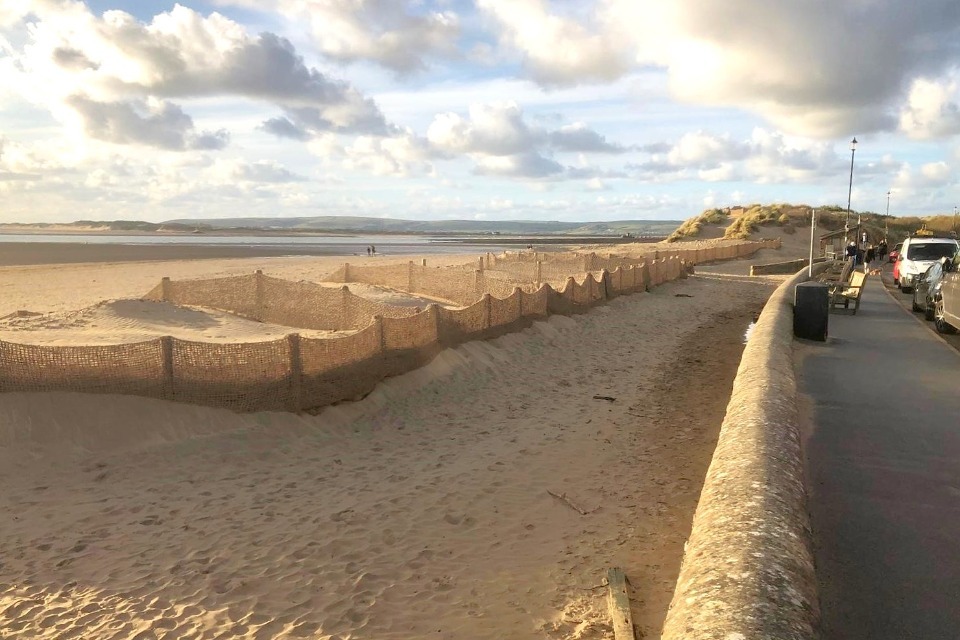
Sand dune restoration, Instow. Image credit: North Devon Biosphere.
Coastal sand dunes provide a natural flood defence and erosion protection from storm surges. They also have many other functions and benefits.
By fully adopting ‘working with natural processes’ sand dunes would be left unmanaged to evolve in response to prevailing winds, tides and waves.
3.1 What we know
We have high confidence in the effect that sand dune management has on flood and coastal erosion risk.
We know that:
- coastal sand dunes play a significant role in coastal flood and erosion defence, as well as being important for nature conservation, recreation and a range of other reasons
- sand dunes are dynamic features, which is part of their benefit as natural flood defences; this does mean that changes can be unpredictable and rapid
- where sand dune systems lose a lot of sediment, there is a risk that dunes will not recover following storm events, and a reduction in their flood defence value is likely unless remedial works are carried out
- a range of measures are available; decisions on the most suitable solution will be site-dependent due to the range of different dune systems and environments along the coastlines of England and Wales
- vegetated sand dunes are often more effective at reducing wave energy than unvegetated sand dunes, but the vegetation can over-stabilise dunes, limiting their natural dynamic behaviour
- plant roots help to strengthen the cohesiveness of sand dunes
- species with greater root systems reduce erosion rates
- sand trapping fences can help in developing sand dunes
- dunes have many wider benefits beyond flood and coastal erosion risk management (FCRM), and in many cases in the UK they are currently restored or managed for biodiversity and amenity purposes rather than their FCRM role
3.2 Examples
At Hightown, works were carried out to reinstate dunes to the same position they were in 30 years ago. Increasing the dune volume by 28,000 m3 has ‘bought’ the frontage 28 years of time. Before the project, this section of coast was losing, on average, 1,000 m3 of sand each year.
The abundance of 6 early colonising dune-building species across 71 beach foredune sites was examined in Australia to predict the response of foredune plant communities to increased erosion. The study indicates that foredune plant communities are valued due to their role in mitigating coastline erosion and flooding, and in many regions vegetated dunes have been encouraged to form or have been created as defences against coastal hazards (Konlechner and others, 2019).
Natural Resources Wales (NRW) has restored 2,400 hectares of sand dunes across 10 separate Welsh sites, through the Sands of LIFE project. The study aims to re-profile dunes to allow for dynamic movement, lower the surface of dried-out slacks to re-create wet pools, and remove scrub and invasive species to investigate best management techniques for flood risk and improving the Wales’ wellbeing goals (NRW, 2024).
UK project examples include the Dynamic Dunescapes project.
3.3 Multiple benefits
Sand dunes provide a wide range of benefits across most of the ecosystem services, the greatest benefit being biodiversity.
New literature suggests that sand dune management may provide natural and efficient protection from eroding storms, limiting flood risk, pollutant filtration and providing bird nesting sites. Sand dunes also provide benefits to education, community ownership and improved beach quality. Benefits to climate regulation and air quality are more limited.

3.4 We need to learn more about
We need to better understand:
- performance across a wide range of different sites in the UK through monitoring and knowledge sharing
- the best ways to use sand dune management measures, such as the best positioning of fencing, and encourage dynamic processes
- long-term response and, therefore, resilience of vegetated versus non-vegetated dune systems to a storm or series of storms, through monitoring
- how to predict future changes to prevailing conditions, particularly at a local level, and the impact of future management both locally and along adjacent shorelines
- potential risk that some dune systems could experience a catastrophic adjustment, with major implications for flood defence, and whether it is possible to understand a site’s risk and whether it may be able to accommodate future change
3.5 References
KONLECHNER, KENNEDY, COUSENS, & WOODS, 2019. Patterns of early-colonising species on eroding to prograding coasts; implications for foredune plant communities on retreating coastlines. 327. Geomorphology. 404–416
NATURAL RESOURCES WALES, 20/032024. Sands of LIFE [Online]. Available from: https://naturalresources.wales. [Accessed: 2 April 2024]
4. Reefs
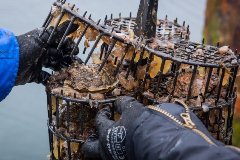
Oyster reef monitoring, Hartlepool. Image credit: Stronger Shores
A reef is a shallow, submerged structure in the ocean or coastal areas.
Reefs function as a natural breakwater. They reduce wave energy as waves pass over a submerged reef, or intercept waves and create shelter in the lee of an exposed reef.
The term ‘reefs’ includes:
- artificial reefs
- geogenic reefs
- biogenic reefs (in the UK, they are generally made of bivalve molluscs like oysters and mussels and members of the Sabellariidae family)
- hybrid reefs (which combine elements of man-made structures to help mimic characteristics of natural reefs or encourage the accumulation of reef organisms)
4.1 What we know
We have low confidence in the effect that reefs have on flood and coastal erosion risk. There is evidence to show that reefs increase bed friction and facilitate wave attenuation, but there is limited evidence on the optimum depth of a reef to dissipate wave energy and maintain oyster populations in the UK.
We know that:
- reefs increase bed friction, reduce wave energy and accrete sediment on the side of the reef that is protected from the wind and waves
- recycled shell material, referred to as ‘cultch’ and coarse sediment can be used to provide hard substrate that encourages recruitment of oysters; methods for deploying cultch include laying directly on the seabed and containment within structures such as gabion baskets
- reefs can be used as sills or as stand-alone breakwaters to stabilise shorelines
- native oysters occur naturally in water depths ranging from 3 m to 40 m and, therefore, for oyster reefs to be most successful they need to be deployed as a submerged breakwater, but wave attenuation is greatest when the crest of the reef structure is at or above still water level
- oyster reefs are able to adapt to sea level rise through natural growth and can recover quickly after storm events
- wave attenuation is affected by reef material, reef architecture and the extent of oyster recruitment
4.2 Examples
The placement of 0.6 m high oyster reefs on an eroding intertidal mudflat was studied in Bangladesh and was found to reduce wave heights by 95 to 100% adjacent to the reef at water levels of less than 0.5 to 0.6 m (Chowdhury and others, 2019).
Another study looked at the installation of artificial reefs along 630 m of tidal flats in the Netherlands. The structures attenuated, on average, 30% of wave height for water levels below 0.5 m, with a maximum wave height reduction of 60% (Marin-Diaz and others, 2021).
UK projects include Stronger Shores, Solent Seascape and Wilder Humber.
4.3 Multiple benefits
Reefs provide a range of benefits. The greatest ecosystem service benefits are associated with water quality and biodiversity.
New evidence suggests that reefs are designed to encourage oyster production, which supports both recreational and commercial fishing. Oyster reefs can increase sediment stability and organic matter content.

4.4 What we need to learn more about
We need to better understand:
- the optimum depth of a reef to both effectively dissipate wave energy and maintain conditions for oyster recruitment
- methods for developing oyster reefs, including their design, performance and durability of materials
- the long-term effects of oyster reefs for both recruitment and sedimentation
- the conditions affecting oyster recruitment and survival, for example, temperature and salinity, including the impacts of climate change
4.5 References
CHOWDHURY, WALLES, SHARIFUZZAMAN, SHAHADAT HOSSAIN, YSEBAERT, & SMAAL, 2019. Oyster breakwater reefs promote adjacent mudflat stability and salt marsh growth in a monsoon dominated subtropical coast. 9 (1). Sci Rep. 8549
MARIN-DIAZ, FIVASH, NAUTA, TEMMINK, HIJNER, REIJERS, CRUIJSEN, DIDDEREN, HEUSINKVELD, PENNING, MALDONADO-GARCIA, VAN BELZEN, DE SMIT, CHRISTIANEN, VAN DER HEIDE, VAN DER WAL, OLFF, BOUMA, & GOVERS, 2021. On the use of large-scale biodegradable artificial reefs for intertidal foreshore stabilization. 170. Ecological Engineering. 106354
5. Submerged aquatic vegetation (SAV) and kelp
Kelp, The Wherry, South Tyneside. Image credit: Stronger Shores
Submerged aquatic vegetation (SAV) are marine plants found in the ocean and coastal areas.
They act as a natural barrier because they reduce wave energy in shallow areas by slowing down waves as they pass over and through seagrass meadows and kelp forests.
Seagrasses form ‘meadow’ type habitats. There are 2 seagrass species in the UK:
- common eelgrass (Zostera marina) which is primarily subtidal
- dwarf eelgrass (Zostera noltei) which is primarily intertidal
Kelp form ‘forest’ type habitats. A number of different kelp species form a large vertical structure in the water column. Many macroalgal species exist in the UK.
5.1 What we know
We have low confidence in the effect that SAV and kelp have on flood and coastal erosion risk. There is evidence to suggest that SAV increases sedimentation rates and reduces wave energy by imposing a drag force, but there is limited evidence on the long-term influence of SAV and the different types of SAV.
We know that:
- SAV reduces wave energy by imposing a drag force on incoming waves and currents
- kelp moves with wave cycles, minimising drag
- seagrass meadows are able to trap sediment at the plant’s root, increasing sedimentation rates
- different SAV species reduce wave energy to different extents due to their differing growth forms, size, flexibility and other factors
- the ability of SAV to reduce wave energy increases with plant/macroalgae density
- wave attenuation was found to be greater in shallower water depths
- SAV helps to store carbon, improve biodiversity, improve water quality, and can support the seafood industry
5.2 Examples
Modelling of seagrass meadows in:
- Italy showed a 32% wave height attenuation at the storm peak, and a maximum attenuation of 89% (Unguendoli and others, 2023)
- Spain showed an average wave attenuation of 10% and maximum attenuation of 36% (Sierra and others, 2023)
- the United States of America showed wave attenuation between 14% and 8% for return periods between 10 years and 100 years (Godfroy and others, 2017)
The ability of SAV to reduce wave energy increases with plant/microalgae density (Sierra and others, 2023).
UK projects include Stronger Shores, Solent Seascapes, Wilder Humber and Project Seagrass.
5.3 Multiple benefits
Submerged aquatic vegetation (SAV) provides a wide range of benefits, particularly for water quality and biodiversity. New evidence suggests that seagrass may store carbon, providing a climate regulation benefit. It also has some amenity benefit.

5.4 What we need to learn more about
We need to better understand:
- the difference in submerged vegetation flood risk reduction capabilities compared to suspended canopies, as well as variation between species
- how to quantify the ability of seagrass and kelp to reduce wave energy
- the long-term influence of SAV and kelp in reducing flood risk
- the impact of SAV on wave and tidal energy and how to incorporate this flood risk benefit into models
5.5 References
GODFROY, VUIK, VAN BERCHUM, & JONKMAN, 2017. Quantifying Wave Attenuation by Nature-based Solutions in the Galveston Bay. TU Delft
SIERRA, GRACIA, CASTELL, GARCÍA-LEÓN, MÖSSO, & LIN-YE, 2023. Potential of Transplanted Seagrass Meadows on Wave Attenuation in a Fetch-Limited Environment. 11 (6). JMSE. 1186
UNGUENDOLI, BIOLCHI, AGUZZI, PILLAI, ALESSANDRI, & VALENTINI, 2023. A modeling application of integrated nature based solutions (NBS) for coastal erosion and flooding mitigation in the Emilia-Romagna coastline (Northeast Italy). 867. Science of The Total Environment. 161357