Run-off management
Published 12 February 2025
Applies to England and Wales

© Crown copyright 2025
This publication is licensed under the terms of the Open Government Licence v3.0 except where otherwise stated. To view this licence, visit nationalarchives.gov.uk/doc/open-government-licence/version/3 or write to the Information Policy Team, The National Archives, Kew, London TW9 4DU, or email: psi@nationalarchives.gov.uk.
Where we have identified any third party copyright information you will need to obtain permission from the copyright holders concerned.
This publication is available at https://www.gov.uk/government/publications/natural-flood-management-evidence/run-off-management
1. Soil and land management
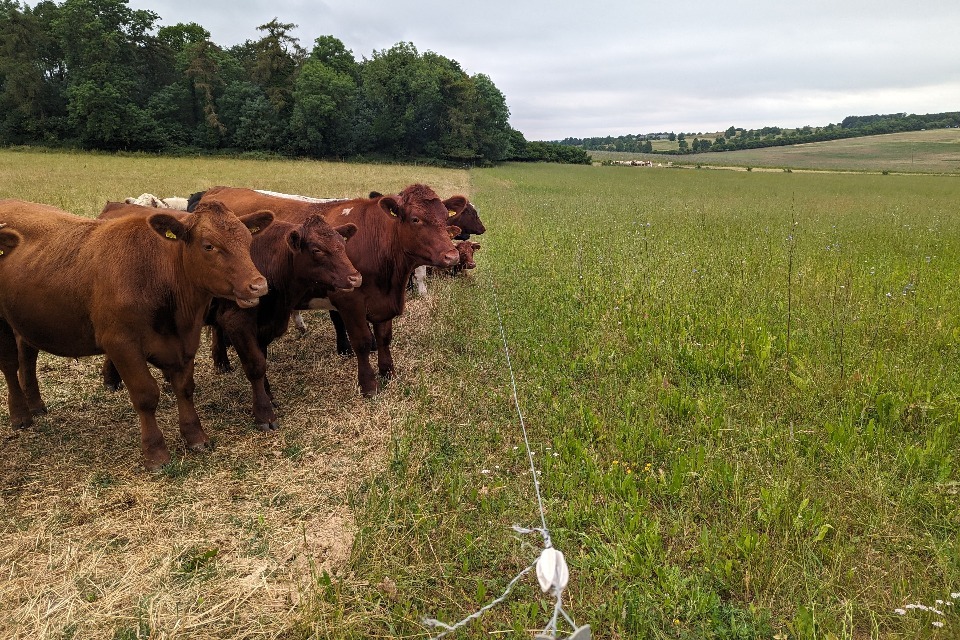
Soil management through mob grazing, Regenerative Agriculture Festival Groundswell. Image credit: Sophia Craddock, Environment Agency
Soil and land management techniques can improve soil health and water management. They include:
- soil aeration, subsoiling and measures to reduce soil compaction
- reducing stocking density
- improving vegetation cover
- conservation tillage
- cover cropping
- crop rotations
- regenerative agriculture
Improved soil and land management practices can increase the amount of surface storage, surface roughness, the rate of infiltration, and the capacity of the soil to store water.
The extent to which these measures reduce flood risk depends on the initial soil wetness, location and the area of land managed relative to the size of the catchment.
Soil and land management techniques are grouped under 3 categories:
- reducing soil compaction
- arable systems
- grassland systems
Measures to reduce soil compaction include soil aeration, subsoiling and spiking and tend to work best when paired with changes to land management and farming practices. These techniques can be applied across all farmed systems.
In arable systems, horticulture, root crops and late harvested crops (which require cultivation at set times) increase soil compaction and can leave land bare during the winter. Measures to address this include:
- roughening the soil surface
- disrupting tramlines
- appropriate use of vehicles and low ground pressure equipment
- ensuring timeliness of operations
- increasing green cover and soil organic matter
In grassland systems, techniques can include:
- employing sustainable stock management
- timing of grazing
- management of vegetation cover to increase surface roughness
1.1 What we know
Soil and land management is a broad and complex area which has seen a large growth in evidence over recent years.
There is further evidence to show that good soil and land management increase hydraulic conductivity and infiltration rates, with growing evidence at the hillslope scale but limited catchment scale evidence of reduced flood risk.
Soil aeration and subsoiling and measures to reduce soil compaction
We have medium confidence in the effect that soil aeration, subsoiling and measures to reduce soil compaction have on flood risk.
Measures to reduce soil compaction:
- can increase hydraulic conductivity and the ability of water to infiltrate and be stored in soil; and there is evidence to show the effect of soil compaction on run-off at a catchment scale, however there is low confidence in its ability to significantly reduce flood risk downstream
- have conflicting evidence of the flood benefits of soil aeration and subsoiling for increasing frequency and magnitude rainfall events, at a catchment scale
Arable systems
We have low to medium confidence in the effect that techniques suited to arable systems have on flood risk.
In arable systems:
- there is limited evidence from the UK (which is also conflicting) that shows changes in crop management may reduce flood risk locally or at the catchment scale
- soil cultivation or tillage (such as to break a plough pan) can in the short term, have positive effects on soil water retention capacity by decreasing soil bulk density and increasing porosity
- the evidence for flood risk reduction of early sowing and cover crops is conflicting
- several lab studies have investigated the impact of roots on soil infiltration; plants with deeper and more vertically oriented roots tend to improve soil infiltration more than other plants, supporting existing understanding on soil infiltration
Grassland systems
We have high confidence in the effect that techniques suited to grassland systems have on flood risk.
In grassland systems:
- multiple modelled studies have shown that reducing stocking density can reduce peak flow, however there are limited findings from monitoring studies
- scientific studies can be conflicting in some cases, it is assumed that trampling will cause compaction and reduce infiltration, while in other studies no significant difference was witnessed between soil infiltration rates on grazed and ungrazed plots, timing of grazing can help to reduce compaction risks
- multiple observed studies showed increasing vegetation cover slows the flow of run-off and attenuates water by increasing surface roughness
- modelled studies reverting arable land to pasture show increased evapotranspiration
- we have strong evidence to suggest that seasonal changes in vegetation mean that overland flow peaks vary over the course of a year
- multiple observed and modelled studies have shown that reducing stocking density to reduce compaction and increasing vegetation cover to increase surface roughness and evapotranspiration which all help reduce peak flow
- any changes in management practices may need to be sustained in the long term to see benefits
1.2 Examples
In a modelled study in the Brimfield Brook (30 km2) catchment, subsoiling, reduced stocking densities and reducing soil compaction across 3% of the catchment reduced the flood peak by 1%. It is estimated that the flood peak could be reduced by 11 to 17% (for a 1:2- and 1:100 -year event respectively) if all of the catchment had land management measures implemented (Lewis and Hodges, 2021).
In a modelled study in Bishopdale (38 km2), reducing the grazing density on 26.3% of the catchment reduced peak run-off by 7% and increased lag time by 8% (1:100-year event). It also improved soil infiltration and soil structure (Kingsbury-Smith and others, 2023).
In a plot-scale monitoring study on stagnosol pastures, soil aeration decreased the likelihood of infiltration excess overland flow from 11.4% to 0.09% for all rainfall events (Wallace and Chappell, 2019).
1.3 Multiple benefits
Soil and land management may improve water and soil quality, and can be beneficial for water resources. New evidence suggests that Culm grassland stabilises the water table, increasing baseflow and slowing the release of water, contributing to drought resilience, and grass leys may reverse structural degradation and increase wheat yields. There is conflicting understanding on the impact on soil organic carbon, depending on the measure implemented. There was no new evidence found for wider grassland types. There are potential biodiversity and some climate regulation and air quality benefits. Amenity benefits are more limited.

1.4 What we need to learn more about
We need to better understand:
- the impact of degraded compared with healthy habitats on flood risk management
- improved understanding across a wider range of habitats and their management to reduce flood risk
- the impacts at larger scales and the potential effects of peak synchronicity
- more complex, long-term field experiments looking at multiple alternative agricultural systems in whole catchments and the maintenance required to sustain improvements
- analysis of the effects of a range of potential system changes on flood risk
- effects in different soil types, conditions (levels of degradation), geologies and depths
- the dynamic nature of soil structure over the seasons
1.5 References
KINGSBURY‐SMITH, WILLIS, SMITH, BOISGONTIER, TURNER, HIRST, KIRKBY, & KLAAR, 2023. Evaluating the effectiveness of land use management as a natural flood management intervention in reducing the impact of flooding for an upland catchment. 37 (4). Hydrological Processes. e14863
LEWIS & HODGES, 2021a. River Wye and Lugg Natural Flood Management Project: Dulas Brook catchment
WALLACE & CHAPPELL, 2019. Blade Aeration Effects on Near-Surface Permeability and Overland Flow Likelihood on Two Stagnosol Pastures in Cumbria, UK. 48 (6). Journal of Environmental Quality. 1766–1774
2. Run-off pathway management
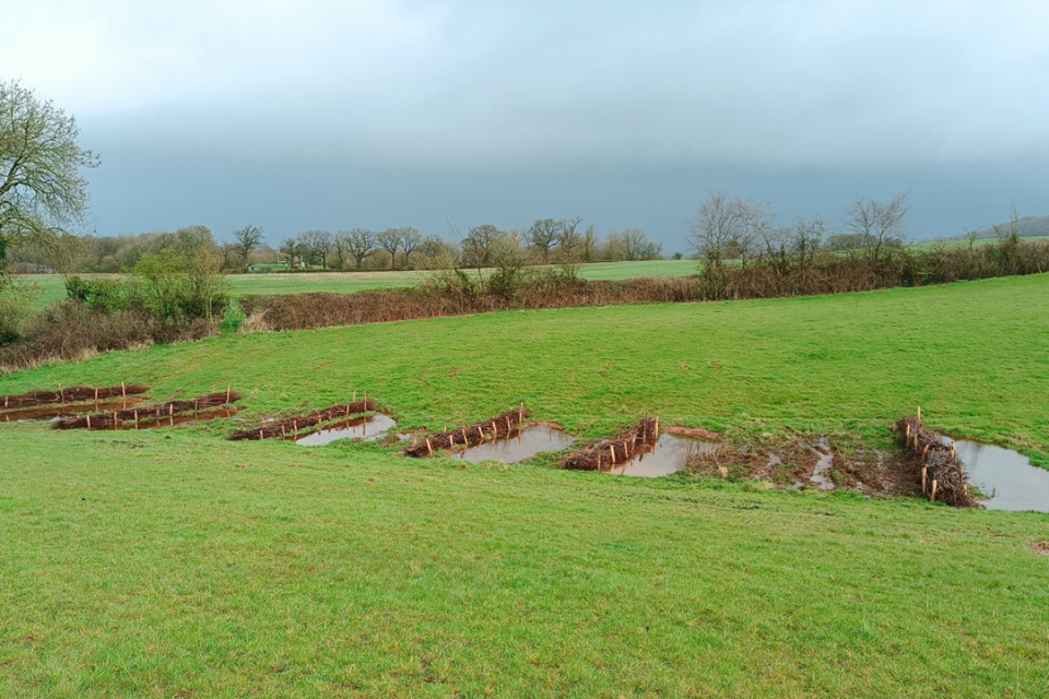
Run-off management features, Ottery St Mary. Image credit: Mehdi Bagheri-Gavkosh, the Devon Resilience Innovation Project (DRIP)
Run-off pathway management measures are intended to mimic natural hydrological regimes. These include:
- run-off attenuation features (RAFs)
- hedges
- buffer strips
- track management
They have the potential to regulate run-off by temporarily storing floodwater, disconnecting and lengthening flow pathways or increasing travel time, and roughening the surface during flood events.
2.1 What we know
We have high confidence in the effect that run-off pathway management has on flood risk. There is further evidence to show that run-off management measures store water and slow the flow downstream, but there remain few studies that have looked into effects at large catchment scales.
Run-off attenuation features
We currently understand that run-off attenuation features:
- are effective as soon as they are installed
- are more effective in reducing local flood peaks for small, common, flashy events, according to many studies, but are unlikely to provide significant flooding benefits on their own
- work best when many clusters of features are included throughout the landscape, working as a network of measures rather than one dominant measure
- have minimal impacts on flow once they are filled with water
- can trap fine sediment, reducing the amount that enters watercourses, maintaining the capacity of rivers to convey floodwaters
- need maintenance; this is often sediment removal
- can prematurely fill before a storm peaks, but several studies show that for smaller capacity ponds, larger outflow pipes will help to prevent this
Hedges and buffer strips
We currently understand that:
- hedges and buffer strips can slow flows and store water immediately upslope through improved infiltration in nearby soils, however there is limited evidence for hedges reducing flood risk at a catchment scale
- buffer strips reduce flood risk further when implemented over a greater area; integrated buffer zones (with storage and outflow) perform more effectively, while wider buffer strips are more effective at reducing peak flow and time-to-peak
2.2 Examples
During 3 flood events in 3 days, 2 bunds on Corney Fell catchment (1 km2) reduced the total catchment stream flow by 3 to 4% in the first flood peak, reducing to ~1 to 2% in the second peak, and had overtopped by the third peak (West Cumbria Rivers Trust, 2021d).
Hedges installed on the Rogerscale floodplain in Cockermouth acted as a leaky dam, with water levels during high flow events up to 36 cm higher upstream of the hedge than downstream. In all 5 recorded events, the peak depth downstream was between 41 and 51% lower than the peak depth upstream of the hedge (West Cumbria Rivers Trust, 2021b).
2.3 Multiple benefits
Run-off pathway management may be beneficial for water resources, flood risk reduction and water quality. Depending on the type of run-off pathway management, there may also be benefits to biodiversity, and it can promote wider ecological resilience. New literature suggests that run-off management techniques often provide good and varied habitat, with hedges and buffer strips additionally allowing for improved habitat connectivity. Ponds allow water-borne sediment and associated pollutants to settle, however the degree of benefit depends on the size and geophysical context. Run-off pathway management provides limited climate regulation and soil benefits. It has very limited air quality and amenity benefit.

2.4 What we need to learn more about
We need to better understand:
- benefits to flood risk through more UK-based monitoring of swales and sediment traps
- effects at larger catchment scales and in different catchment types and geologies
- the storage-discharge relationships for a range of RAF types
- how sediment trapped in RAFs helps reduce the amount of sediment entering watercourses and, therefore, the potential flood risk benefits of improving channel conveyance
- the benefits of different hedge types (for example, banked/kested hedges)
- how ditch management affects flood risk
- how much storage is required to gain a specific flood risk reduction, for any catchment, while considering the number and types of features and risks of peak synchronisation
- tools that can identify where wider buffer strips would be beneficial
- the impact of RAFs on increasing infiltration in different catchment types and geologies
2.5 References
WEST CUMBRIA RIVERS TRUST, 2021b. Natural Flood Management Performance Monitoring - Rogerscale floodplain restoration. West Cumbria Rivers Trust
WEST CUMBRIA RIVERS TRUST, 2021d. Natural Flood Management Performance Monitoring, Corney Fell water storage areas, Update November 2021 management practices can increase the amount of surface storage, surface roughness, the rate of infiltration, and the capacity of the soil to store water. The size of the effect that these measures have on flood risk depends on the location and the area of land managed relative to the size of the catchment.
3. Headwater drainage management
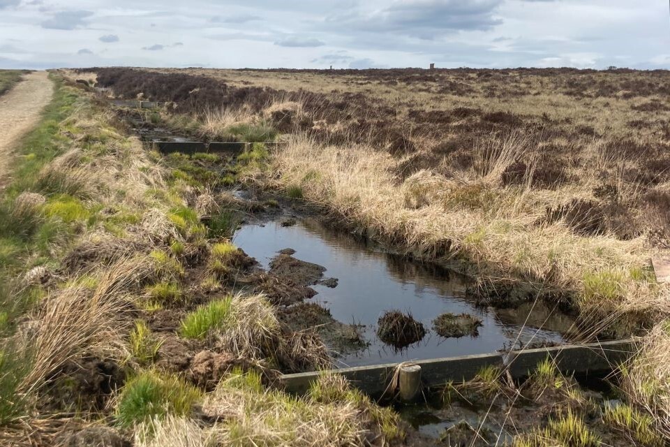
Series of peatland wooden grip blocks, Darwen Moor. Image credit: Eleanor Heron, Environment Agency
Headwater peatland management aims to retain water within peatland habitats to reduce run-off downstream.
Vegetation management is the deliberate planning and maintenance of the plant life within peatland. This includes:
- re-establishing natural conditions
- planting native plants
- controlling invasive plants
Gully and grip blocking is the placement of structures such as dams or barriers within channels or grips to slow the movement of water within them. While gullies are naturally occurring, grips are man-made drainage channels. This allows water to be absorbed by peatland habitats instead of flowing downstream.
Pipe blocking is the obstruction of pipe outlets, preventing water from flowing out of the pipe, allowing the water to be absorbed by peatland habitats instead of flowing downstream. Pipes are naturally occurring features in the landscape.
3.1 What we know
We have medium confidence in the effect that headwater peatland management has on flood risk because of the lack of catchment-scale studies.
We found that headwater peatland management measures:
- can slow stormwater as it moves through the catchments, attenuating flow and altering the storm hydrograph, with potential flood risk benefits downstream
- can take time to become effective; their effectiveness is not static over time as soil properties change and adapt to the restoration measures, with positive and negative effects on the discharge rate
- which replace bare peat with vegetation can reduce run-off rates through increased hydraulic roughness, potentially delaying peak flows; there is significant evidence for this at a range of scales
- specifically grip blocking can reduce flood risk, but evidence is not consistent; it can either increase or decrease discharge rates at a hill slope scale
- specifically grip blocking can be effective in reducing peak flows and restoring peatland habitat, but it is never as effective as intact peat
- specifically gully blocking has limited studies on run-off rates to determine with confidence their flood risk benefits
- specifically pipe blocking has conflicting evidence on streamflow, although flood risk benefits appear to be small and based on limited evidence
- have significantly longer lag times under revegetation scenarios, which increase with the addition of gully and grip blocking according to several studies
- can reduce flood risk downstream; the amount of peatland undergoing restoration, the topography and the placement of restoration projects significantly affects the level of these reductions
- can encounter experimental problems due to the large scales involved and the lack of control catchments due to the complexity of restoration
- with dense sphagnum consistently delay and reduce river flow peaks during modelled rainfall events, according to a modelled catchment study that compared vegetated areas to bare peat
- include a range of different interventions, the suitability of which will depend as much on the current state of the peatland and the channels, as it will on the desired outcome in terms of flood risk
3.2 Examples
In 3 headwater catchments in the Pennines, revegetation of peatland increased the depth of the water table, increased the lag time of the hydrograph by 106%, and decreased peak flows by 27% (Shuttleworth and others, 2019).
Blocking erosion features in Dartmoor saw the mean water table rise from 3 mm below the surface to 64 mm above in peat pans, enabling surface water to accumulate. Disconnecting flow pathways resulted in an average 49% decrease in peak event discharge (Gatis and others, 2023).
A modelled study comparing bare peat and dense sphagnum cover in a catchment showed delayed and reduced river flow peaks in the vegetated scenario, across all modelled rainfall events (Gao and others, 2017).
In small rainfall events in the Spooner catchment on shallow peat on Exmoor, peak event discharge decreased by 29% following ditch blocking for peatland restoration (Brazier and others, 2020).
3.3 Multiple benefits
Headwater peatland management may result in benefits to biodiversity, climate regulation, water resources, soil and water quality. New research suggests that there is limited data for the carbon benefits of grip and gully blocking, however benefits could be realised over longer timeframes as the peatland ecosystem adapts to wetter conditions. Benefits from amenity and air quality improvements are thought to be more limited.

3.4 What we need to learn more about
We need to better understand:
- if there are any lasting effects or more pronounced impacts through long-term monitoring of peat restoration
- effects in different types of catchments and across all peat depths
- flood risk benefits of headwater peatland management (particularly grip and gully blocking) for bigger flood events at larger catchment scales
- the effects of blocking peat pipes on flood risk
- how flood flows are affected when headwater management features are full
- ongoing maintenance requirements for headwater peatland management
- when and how to restore peatland to maximise flood risk benefits
- the permeability of stone dams once clogged with sediment and/or peat
- whether pipe-connected pools work differently to disconnected pools
- the effects on flood risk from different design approaches
- wider peatland management practices, including the effects of burning on flood risk
- the temporal changes in flood risk following peatland restoration
3.5 References
BRAZIER, ANGUS, BENAUD, GATIS, LUSCOMBE, ANDERSON, ASHE, BARROWCLOUGH, CARLESS, FREEMAN, GILLARD, GRAND-CLEMENT, HAND, MALONE, MCALEER, & SMITH. 2020. Mires on the Moors: Science and Evidence Report 2020, University of Exeter, Exeter, UK.
GAO, HOLDEN, & KIRKBY, 2017. Modelling impacts of agricultural practice on flood peaks in upland catchments: An application of the distributed TOPMODEL. 31 (23). Hydrological Processes. 4206–4216
GATIS, BENAUD, ANDERSON, ASHE, GRAND-CLEMENT, LUSCOMBE, PUTTOCK, & BRAZIER, 2023. Peatland restoration increases water storage and attenuates downstream stormflow but does not guarantee an immediate reversal of long-term ecohydrological degradation. 13 (1). Scientific Reports. 15865
SHUTTLEWORTH, EVANS, PILKINGTON, SPENCER, WALKER, MILLEDGE, & ALLOTT, 2019. Restoration of blanket peat moorland delays stormflow from hillslopes and reduces peak discharge. 2. Journal of Hydrology X. 100006